2.6.31. RGS
2.6.31.1. Introduction
Royal Geographic Society building in the London borough of Chelsea and Kensington. Several Ceilometers, microlites and Soil Moisture Probes have been deployed here.
2.6.31.2. Site metadata
Site ID |
RGS |
|
|---|---|---|
Full Name |
Royal Geographical Society |
|
Network |
LUMA |
|
Longitude |
-0.17492 |
degrees |
Latitude |
51.501517 |
degrees |
Start date |
2009-03-26 |
UTC |
End date |
UTC |
|
Displacement height |
-999.0 |
m |
City |
London |
2.6.31.3. Deployments at site
Deployment ID |
Instrument ID |
Instrument serial |
Type |
Deployment name |
Start date |
End date |
|---|---|---|---|---|---|---|
UTC |
UTC |
|||||
277 |
indoor |
Microlite Catherine - Bad data |
2016-05-05 |
2016-05-09 |
||
278 |
indoor |
Microlite RGS |
2016-05-10 |
2018-09-12 |
||
281 |
indoor |
Microlite RGS |
2016-05-25 |
2018-09-12 |
||
282 |
ceilometer |
CT25K-Y |
2016-05-25 |
2018-07-17 |
||
283 |
ceilometer |
CL31-B |
2009-03-26 |
2016-06-14 |
||
373 |
ceilometer |
CL31-B |
2016-06-26 |
2020-03-17 |
||
285 |
single |
Node 4 |
2016-06-07 |
2016-07-25 |
||
286 |
single |
Node 3 |
2016-06-14 |
2016-07-25 |
||
293 |
single |
Node 4 |
2016-07-26 |
2016-08-15 |
||
294 |
single |
Node 3 |
2016-07-26 |
2020-10-22 |
||
297 |
single |
Node 4 |
2016-08-16 |
2017-06-21 |
||
383 |
ceilometer |
CL31-D |
2011-01-19 |
2011-02-02 |
||
400 |
single |
Node 5 |
2017-06-21 |
2020-10-22 |
||
450 |
ceilometer |
CT25K-X |
2018-07-17 |
|||
471 |
ceilometer |
CL31-A |
2021-07-15 |
Deployment ID |
Height |
Yaw |
Pitch |
Roll |
|---|---|---|---|---|
m asl |
degrees |
degrees |
degrees |
|
277 |
0.0 |
0.0 |
0.0 |
0.0 |
278 |
0.8 |
0.0 |
0.0 |
0.0 |
281 |
0.8 |
0.0 |
0.0 |
0.0 |
282 |
28.1 |
0.0 |
5.0 |
0.0 |
283 |
28.1 |
0.0 |
5.0 |
0.0 |
373 |
28.1 |
0.0 |
4.0 |
0.0 |
285 |
-0.15 |
|||
286 |
-0.1 |
|||
293 |
-0.15 |
0.0 |
0.0 |
0.0 |
294 |
-0.1 |
0.0 |
0.0 |
0.0 |
297 |
-0.15 |
0.0 |
0.0 |
0.0 |
383 |
28.1 |
0.0 |
0.0 |
0.0 |
400 |
-0.15 |
0.0 |
0.0 |
0.0 |
450 |
28.1 |
0.0 |
5.0 |
0.0 |
471 |
28.1 |
0.0 |
1.0 |
0.0 |
Deployment ID |
Profile bottom |
Profile top |
Profile step |
|---|---|---|---|
m asl |
m asl |
m |
|
282 |
28.1 |
30.0 |
|
283 |
28.1 |
10.0 |
|
373 |
28.1 |
10.0 |
|
383 |
28.1 |
7728.1 |
10.0 |
450 |
28.1 |
30.0 |
|
471 |
28.1 |
10.0 |
Deployment ID |
Room type |
Building storey |
Distance to wnidow |
|---|---|---|---|
m |
|||
277 |
Office |
2.0 |
2.0 |
278 |
Office |
2.0 |
2.0 |
281 |
Office |
2.0 |
2.5 |
2.6.31.4. Photos
.jpg)
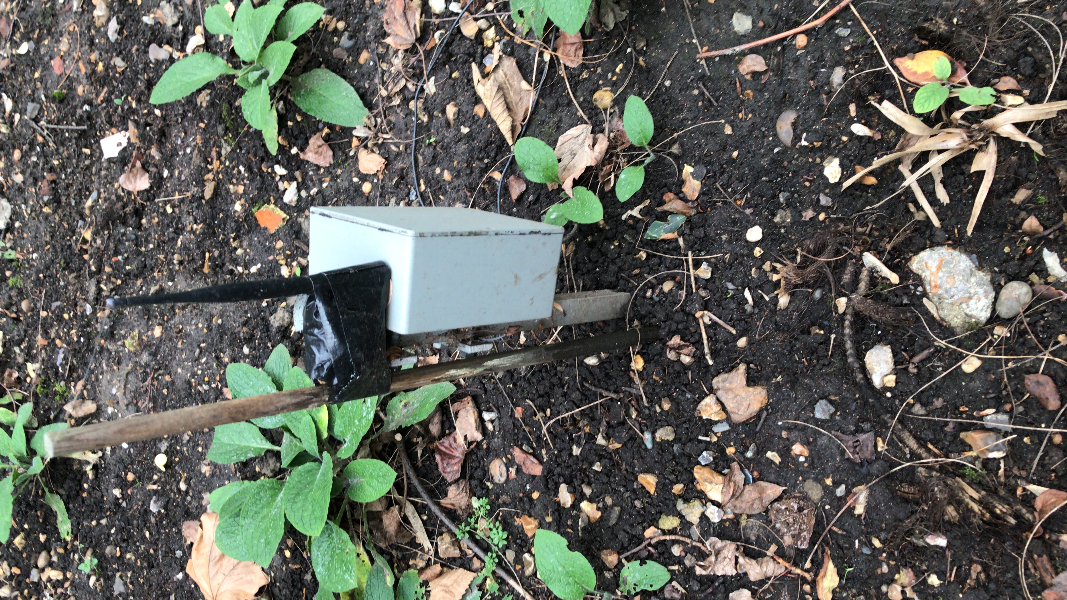
Fig. 2.91 Soil moisture probe node 18-02-2020.
.jpg)
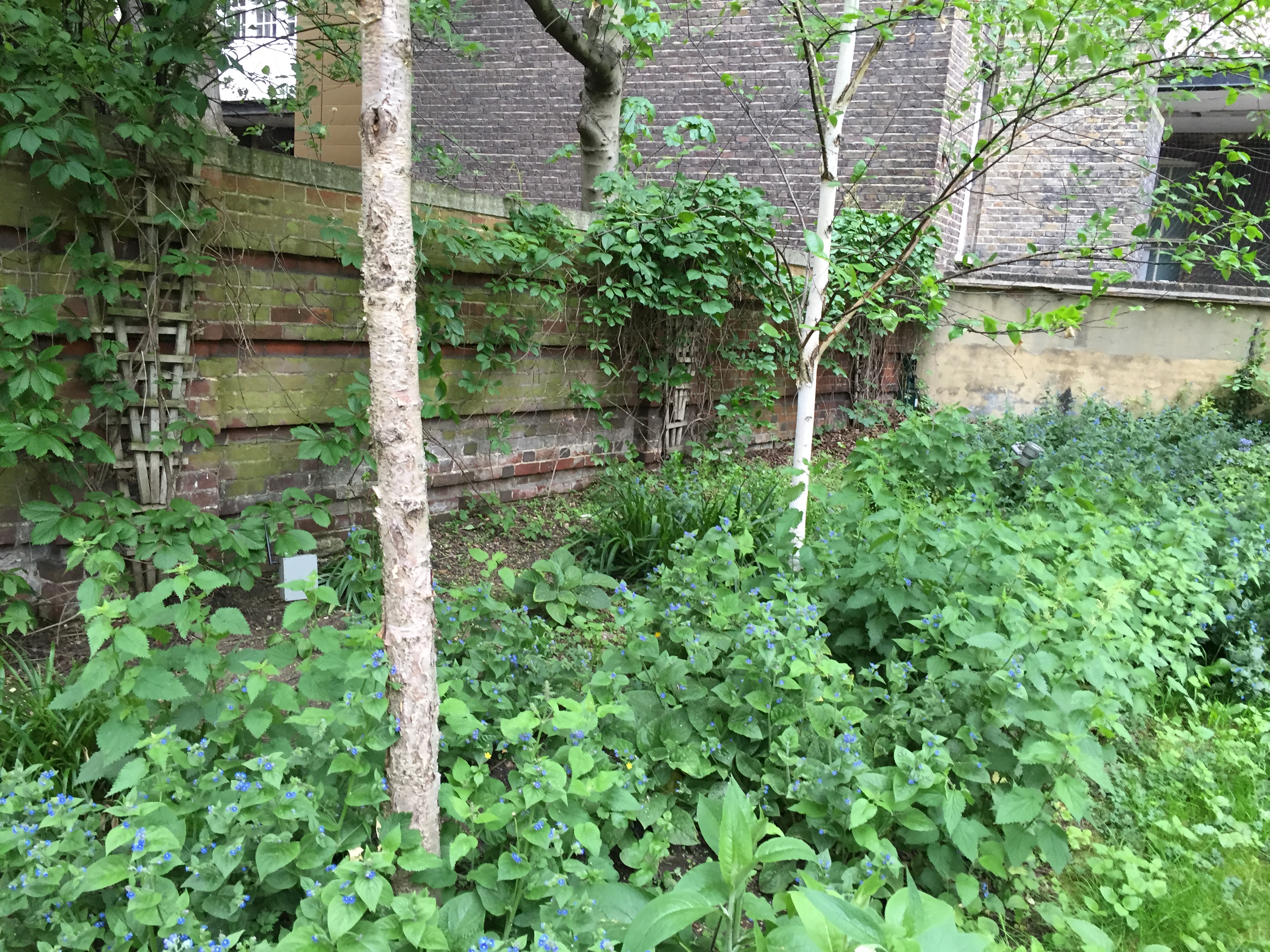
Fig. 2.93 Soil moisture nodes in flower bed 25-05-2016.
2.6.31.5. Data acquisition
Data can be requested from Prof. Sue Grimmond (c.s.grimmond@reading.ac.uk).
2.6.31.6. Data availability
Double click on legend to isolate instruments.
2.6.31.7. References
Kotthaus, S., Halios, C. H., Barlow, J. F. and Grimmond, C. S. B. (2018) Volume for pollution dispersion: London’s atmospheric boundary layer during ClearfLo observed with two ground-based lidar types. Atmospheric Environment, 190. pp. 401-414. ISSN 1352-2310 doi: https://doi.org/10.1016/j.atmosenv.2018.06.042
Warren, E., Charlton-Perez, C., Kotthaus, S., Lean, H., Ballard, S., Hopkin, E. and Grimmond, S. (2018) Evaluation of forward-modelled attenuated backscatter using an urban ceilometer network in London under clear-sky conditions. Atmospheric Environment, 191. pp. 532-547. ISSN 1352-2310 doi: https://doi.org/10.1016/j.atmosenv.2018.04.045
Kotthaus, S., O’Connor, E., M�nkel, C., Charlton-Perez, C., Haeffelin, M., Gabey, A. M. and Grimmond, C. S. B. (2016) Recommendations for processing atmospheric attenuated backscatter profiles from Vaisala CL31 ceilometers. Atmospheric Measurement Techniques, 9. pp. 3769-3791. ISSN 1867-8548 doi: https://doi.org/10.5194/amt-9-3769-2016
2.6.31.8. Acknowledgements
We thank Catherine Souch at Royal Geographical Society for site access.
Tip
Stuck? the user guide is a useful place to start.
Please report issues at GitHub Issues. Go from the page with the problem - an automatic link will be inserted. Thanks.