2.6.22. KSS45W
2.6.22.1. Introduction
Roof of Strand building of Kings College, 45 metres to the West of KSS, in the City of Westminster, London. Same building as KSB, KSSW and KSS. A CL31, infrared camera, weather and radiation sensors were deployed here.
2.6.22.2. Site metadata
Site ID |
KSS45W |
|
|---|---|---|
Full Name |
Strand Building, Kings College London (Strand Campus) 45m west of KSS |
|
Network |
LUMA |
|
Longitude |
-0.11675 |
degrees |
Latitude |
51.51178 |
degrees |
Start date |
2009-10-01 |
UTC |
End date |
2016-04-14 |
UTC |
Displacement height |
19.0 |
m |
City |
London |
2.6.22.3. Deployments at site
Deployment ID |
Instrument ID |
Instrument serial |
Type |
Deployment name |
Start date |
End date |
|---|---|---|---|---|---|---|
UTC |
UTC |
|||||
5 |
single |
Davis weather station A - check end date - no raw data |
2011-04-21 |
2011-09-01 |
||
6 |
single |
Davis weather station B - no raw data |
2011-04-21 |
2011-05-16 |
||
18 |
single |
PIR |
2012-02-27 |
2016-04-14 |
||
19 |
single |
PSP |
2012-02-27 |
2016-04-14 |
||
20 |
single |
UVA |
2012-02-27 |
2016-04-14 |
||
21 |
single |
PAR |
2012-02-27 |
2016-04-14 |
||
22 |
single |
UVB |
2012-02-27 |
2016-04-14 |
||
23 |
single |
SPN |
2011-01-14 |
2016-04-14 |
||
58 |
fov |
MIRICLE Thermal Camera - Check end date! |
2011-05-23 |
2011-10-01 |
||
59 |
single |
ARG100 |
2009-12-17 |
2016-04-14 |
||
279 |
ceilometer |
CL31-A |
2009-04-22 |
2011-12-31 |
||
463 |
ceilometer |
CL31-A |
2012-01-01 |
2016-04-14 |
||
378 |
ceilometer |
CL31-C |
2010-09-21 |
2011-03-02 |
||
379 |
ceilometer |
CL31-D |
2010-09-23 |
2011-01-07 |
Deployment ID |
Height |
Yaw |
Pitch |
Roll |
|---|---|---|---|---|
m asl |
degrees |
degrees |
degrees |
|
5 |
47.6 |
|||
6 |
47.6 |
|||
18 |
47.6 |
0.0 |
0.0 |
0.0 |
19 |
47.6 |
0.0 |
0.0 |
0.0 |
20 |
47.6 |
0.0 |
0.0 |
0.0 |
21 |
47.6 |
0.0 |
0.0 |
0.0 |
22 |
47.6 |
0.0 |
0.0 |
0.0 |
23 |
47.6 |
0.0 |
0.0 |
0.0 |
58 |
47.6 |
180.0 |
||
59 |
46.6 |
0.0 |
0.0 |
0.0 |
279 |
47.6 |
0.0 |
0.0 |
0.0 |
463 |
47.6 |
0.0 |
0.0 |
0.0 |
378 |
47.6 |
0.0 |
0.0 |
0.0 |
379 |
47.6 |
0.0 |
0.0 |
0.0 |
Deployment ID |
Profile bottom |
Profile top |
Profile step |
|---|---|---|---|
m asl |
m asl |
m |
|
279 |
0.0 |
10.0 |
|
463 |
0.0 |
10.0 |
|
378 |
47.6 |
10.0 |
|
379 |
47.6 |
10.0 |
2.6.22.4. Photos
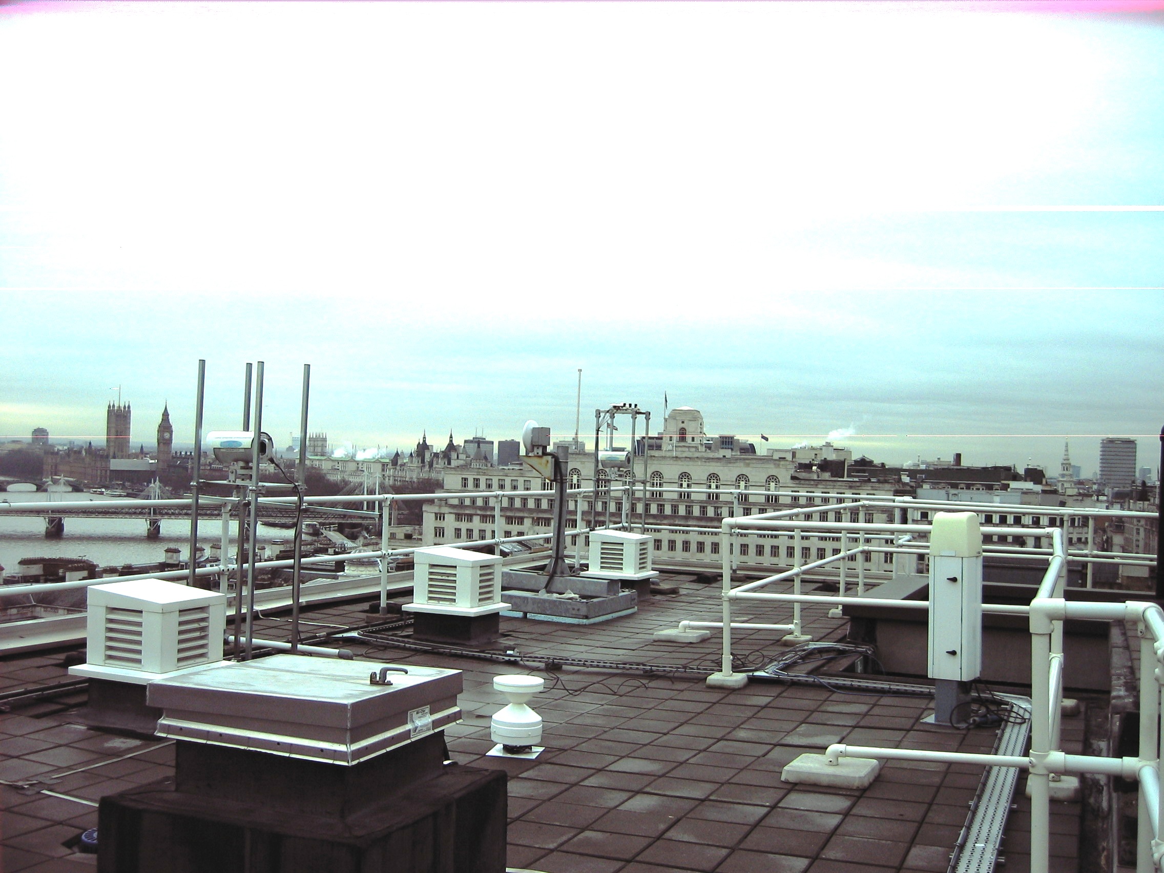
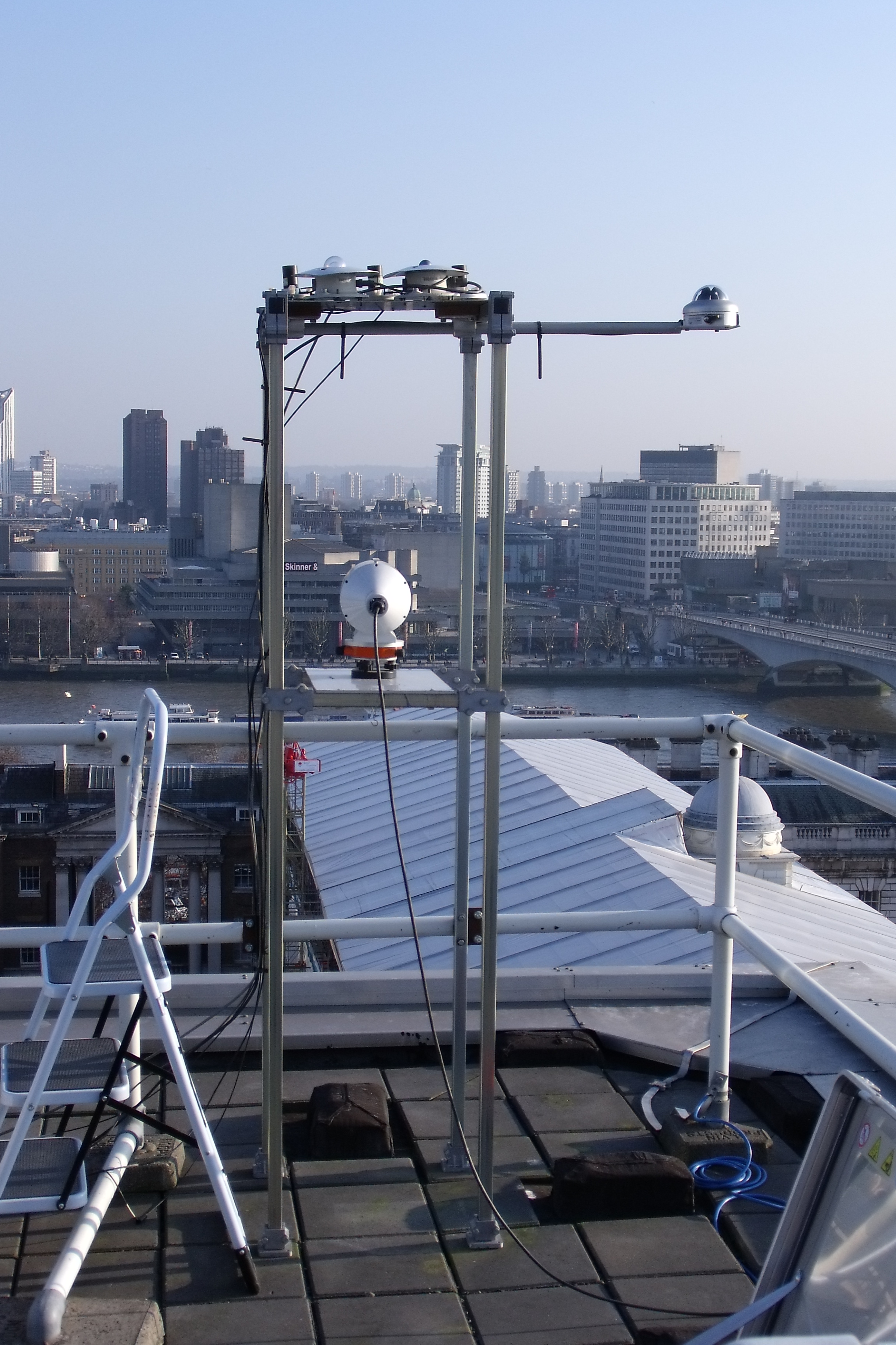
Fig. 2.64 PAR, UVA, UVB, SPN1, PIR, PSP on top of structure 04-03-2011.
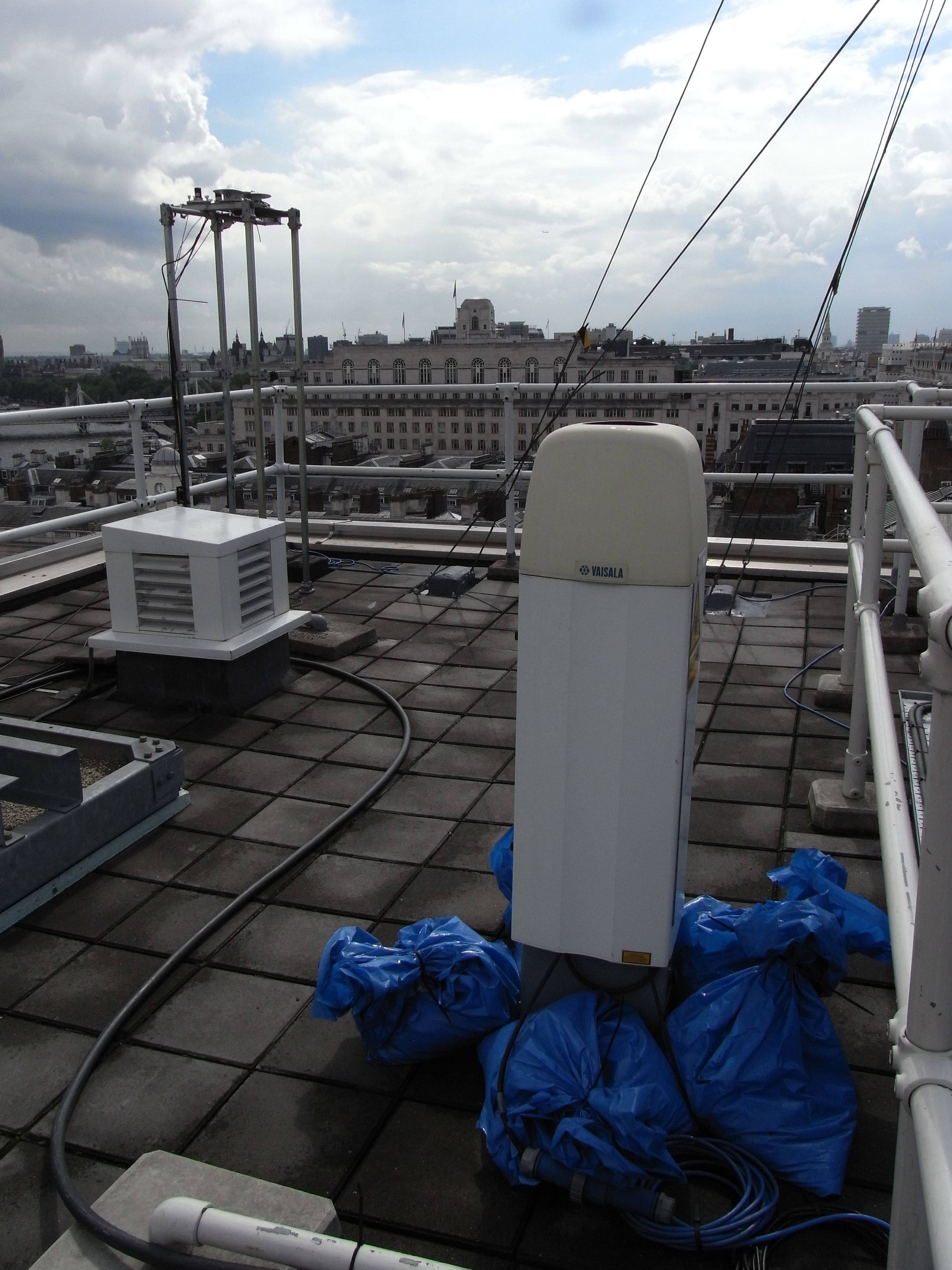
Fig. 2.65 CL31 and PAR, UVA, UVB, SPN1, PIR, PSP on top of structure.
2.6.22.5. Data acquisition
Data can be requested from Prof. Sue Grimmond (c.s.grimmond@reading.ac.uk).
2.6.22.6. Data availability
Double click on legend to isolate instruments.
2.6.22.7. References
Warren, E., Charlton-Perez, C., Kotthaus, S., Lean, H., Ballard, S., Hopkin, E. and Grimmond, S. (2018) Evaluation of forward-modelled attenuated backscatter using an urban ceilometer network in London under clear-sky conditions. Atmospheric Environment, 191. pp. 532-547. ISSN 1352-2310 doi: https://doi.org/10.1016/j.atmosenv.2018.04.045
Kotthaus, S., Halios, C. H., Barlow, J. F. and Grimmond, C. S. B. (2018) Volume for pollution dispersion: London’s atmospheric boundary layer during ClearfLo observed with two ground-based lidar types. Atmospheric Environment, 190. pp. 401-414. ISSN 1352-2310 doi: https://doi.org/10.1016/j.atmosenv.2018.06.042
Bjorkegren, A. and Grimmond, C. S. B., (2017) Net carbon dioxide emissions from central London. Urban Climate, 23. pp. 131-158. ISSN 2212-0955 doi: https://doi.org/10.1016/j.uclim.2016.10.002
2.6.22.8. Acknowledgements
We thank King College London Directorate of Estates Facilities for site access.
Tip
Stuck? the user guide is a useful place to start.
Please report issues at GitHub Issues. Go from the page with the problem - an automatic link will be inserted. Thanks.